
Table of Contents
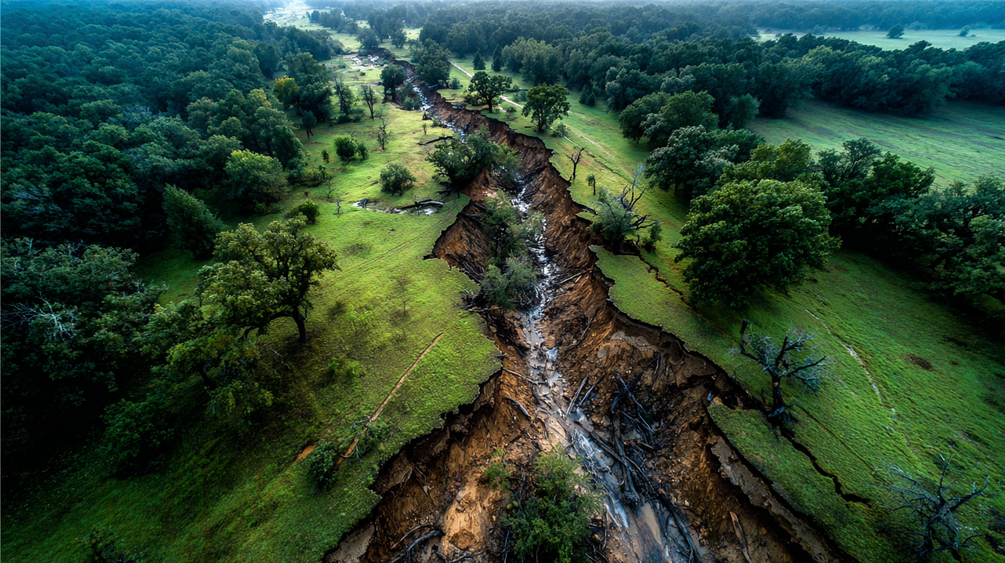
When property lines run along a creek or waterway in Texas, unexpected legal issues arise after major storms. Here’s a common scenario: your deed says the property extends to the center of a creek. After flooding, that creek now flows 20 feet away from its original path. Do your property lines move with the water, or do they stay put?
The answer lies in how Texas law treats different types of watercourse changes.
Two Types of Movement, Two Legal Results
Texas distinguishes between gradual and sudden changes when determining property lines along waterways. This distinction decides whether you’ve gained land, lost it, or own something that no longer makes geographical sense.
Accretion happens when streams shift gradually through natural erosion and sediment deposit. With accretion, property lines move with the water. You might gain several feet of land over a decade as the creek slowly bends away from you or lose it as the water creeps closer.
Avulsion occurs when waterways jump suddenly during floods or severe storms. With avulsion, your legal boundaries don’t budge. The creek might flow through your neighbor’s pasture now, but your property lines remain in the old, possibly dry channel.
The Texas Real Estate Research Center at Texas A&M explains: “When a river changes course ‘suddenly and perceptibly,’ removing or depositing land in doing so, the process is called ‘avulsion.’ In this case, the boundaries of the land do not change, even though the body of water has moved.”
Courts apply a perception test for creek boundaries in Texas: Could someone observe the change happening in real-time? That’s avulsion, the boundaries stay. Could they only notice changes over months or years? That’s accretion, the boundaries shift.
Real-World Implications for Texas Landowners
Consider the 2015 Memorial Day floods that jumped creek channels across Central Texas. Property lines faced immediate questions: Who owns the abandoned channel? Who owns the new creek bed? The answer: whoever owned them before the flood.
This creates peculiar ownership patterns:
- Your property might extend across both sides of the active creek
- The old channel cutting through your neighbor’s field might still be yours
- You could own “waterfront” property where no water flows
- Your neighbor might have water access through land you legally own
These aren’t theoretical problems. The Blanco River’s dramatic course changes have created numerous disputes where property lines sit nowhere near current water flow.
Navigable vs. Non-Navigable: Different Rules Apply
The size of your waterway changes how property lines function along Texas creeks.
Non-navigable streams (under 30 feet average width): Private ownership typically extends to the center. When these smaller creeks shift gradually, property lines follow. When they jump suddenly, boundaries don’t.
Navigable waterways (30+ feet average width): The state owns the streambed. According to Texas Natural Resources Code §21.001(3), any stream “which retains an average width of 30 feet from the mouth up” belongs to the public. If these rivers jump course, property lines remain fixed, but Texas now owns the new riverbed too.
This means boundaries behave differently on the Guadalupe River than on your local farm creek.
Why Understanding Creek Boundaries Matters
Several practical issues depend on correctly establishing property lines along Texas waterways:
Survey accuracy: Standard surveys show where water flows today, not where your legal boundary sits. After major floods, these might be completely different locations.
Water rights: Texas riparian rights require adjacency to waterways. If avulsion moved the creek away from your property lines, you might have lost water access despite owning the same acreage.
Fence obligations: You’re required to fence along your actual boundary, not necessarily along the current creek. This matters for liability and livestock management.
Title insurance: Many title policies exclude coverage for boundary changes along waterways. Understanding how property lines work near water helps you spot coverage gaps.
Tax assessments: Counties assess taxes based on legal acreage, but they might not account for gradual land gains or losses through accretion.
Documenting Changes to Creek Boundaries
Proving how property lines changed along a Texas creek requires specific evidence:
- Historical aerials from Google Earth or USGS archives showing creek position over time
- Flood records from USGS gauge stations documenting specific overflow events
- Survey records noting creek location at different dates
- News accounts of major floods that could constitute avulsion
- Witness testimony from neighbors about sudden vs. gradual changes
Smart buyers investigating waterfront property in Texas request this documentation upfront, especially after recent flooding events.
Mineral Rights Follow the Same Rules
These principles for property lines apply equally below ground. If boundaries shifted through accretion, mineral ownership shifted too. If avulsion occurred, mineral rights remain under the original boundaries—even if that’s now the middle of an active creek.
Texas courts developed much of this law through oil and gas disputes. When horizontal drilling targets specific formations, knowing exactly where property lines sit becomes worth millions.
Practical Steps for Property Owners
If you own land with creek boundaries in Texas, take these actions:
- Document current conditions with aerial photography and surveys
- Research historical movement using USGS maps and county records
- Establish agreements with neighbors about boundary locations
- Update surveys after major flood events, noting whether changes were sudden or gradual
- Review title insurance to understand what’s covered regarding boundary changes
Key Take Aways
Understanding property lines along Texas waterways comes down to speed of change:
- Slow, imperceptible movement over years = boundaries follow the water
- Fast, obvious movement during floods = boundaries stay put
- Navigable waterways = state owns the bed wherever it goes
- Documentation beats memory in court
- Professional surveys should note historical changes
When storms reshape Texas waterways, knowing these rules determines whether you’ve gained land, lost it, or own property in unexpected places.
Please Note
This blog is based on research and it not legal advice or used for legal reference. If you are experiencing property line disputes or have questions on your property lines and locations, you should always consult with a survey company and attorney.
References
- Texas Real Estate Research Center. “Moving Water: Boundary Changes and Property Rights.” Texas A&M University. Available at: https://trerc.tamu.edu/article/moving-water-2361/
- Texas Natural Resources Code §21.001(3) – Definition of Navigable Stream. Texas Legislature. Available at: https://statutes.capitol.texas.gov/
- Texas Parks and Wildlife Department. “Overview of Texas Stream Navigation Law.” Available at: https://tpwd.texas.gov/publications/nonpwdpubs/water_issues/rivers/navigation/riddell/navigability.phtml
- Diversion Lake Club v. Heath, 86 S.W.2d 441 (Tex. 1935). Defining statutory navigability in Texas.
- Texas Natural Resources Code Chapter 12 – Red River Boundary Compact. Available at: https://statutes.capitol.texas.gov/Docs/NR/htm/NR.12.htm
- Combs Law Group. “Flooding of Creek Doesn’t Change Boundary Line.” May 2018. Available at: https://combslawgroup.com/accretion-avulsion/
This week we have been cover water rights and how they affect your property. Make certain to check out Monday and Tuesdays blog.